
The convergence of artificial intelligence, data analytics, and digital twin technology is revolutionizing urban planning, transforming how cities harness infrastructure technology funding to create sustainable, resilient communities. Smart sensors now monitor traffic patterns, air quality, and energy consumption in real-time, enabling urban planners to make data-driven decisions that optimize city operations and improve citizen wellbeing. This technological revolution extends beyond mere efficiency gains—it’s fundamentally reshaping how we conceptualize, design, and manage urban spaces.
Recent advancements in 3D modeling and geographic information systems (GIS) have enabled unprecedented precision in urban development, allowing planners to simulate and evaluate multiple scenarios before breaking ground. These tools, combined with machine learning algorithms, help predict population growth patterns, traffic congestion points, and environmental impacts with remarkable accuracy. The integration of Building Information Modeling (BIM) with city-wide digital platforms has created a new paradigm for collaborative urban development, where stakeholders can visualize and modify plans in real-time, ensuring more inclusive and sustainable urban growth.
As cities worldwide face mounting challenges from climate change, population growth, and resource constraints, technology-driven urban planning has emerged as a critical tool for creating resilient, adaptive cities that serve their inhabitants while protecting the environment. This transformation represents not just an evolution in planning methodology, but a fundamental shift in how we approach urban development for the 21st century.
Digital Twin Technology Revolutionizes City Planning

Real-Time Urban Monitoring Systems
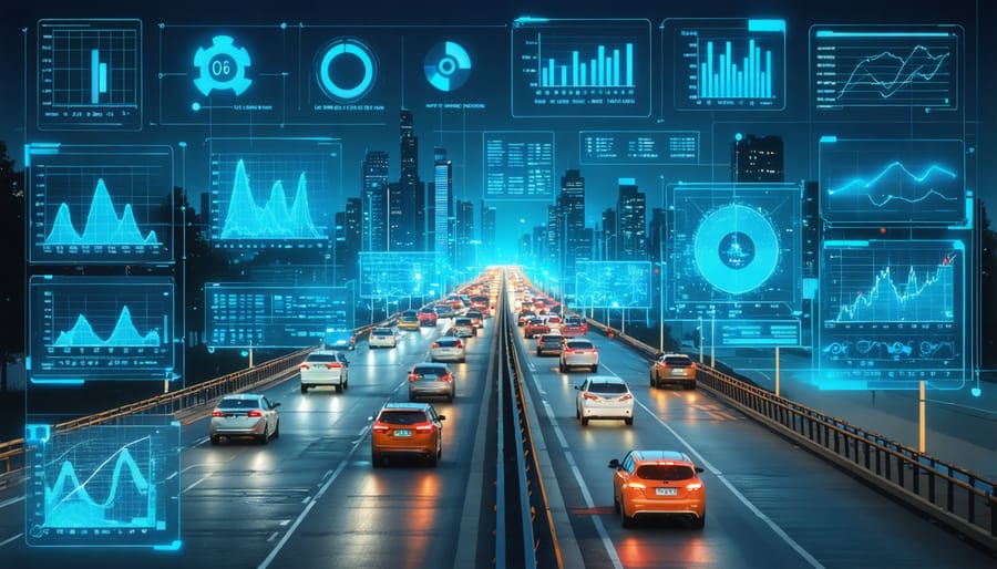
Real-time urban monitoring systems have revolutionized how cities collect, analyze, and respond to urban dynamics. These sophisticated networks combine Internet of Things (IoT) sensors, data analytics platforms, and cloud computing to provide unprecedented insights into city operations.
Modern sensor networks are strategically deployed throughout urban environments to monitor various parameters, including traffic flow, air quality, noise levels, energy consumption, and infrastructure health. These sensors transmit data continuously to central management systems, enabling immediate response to urban challenges and informed decision-making for long-term planning.
The integration of IoT technology has particularly enhanced the capability of these monitoring systems. Smart streetlights can automatically adjust brightness based on ambient conditions, while environmental sensors track pollution levels and weather patterns. Traffic management systems utilize computer vision and AI to optimize signal timing and reduce congestion in real-time.
Several cities have successfully implemented comprehensive monitoring networks. For instance, Singapore’s Smart Nation initiative employs over 50,000 sensors to monitor everything from waste management to public safety. Barcelona’s digital infrastructure includes sensors that manage irrigation systems and parking availability, resulting in significant resource optimization.
The data collected through these systems provides valuable insights for urban planners and city administrators. Real-time monitoring enables predictive maintenance of infrastructure, efficient resource allocation, and enhanced public services. This data-driven approach has demonstrated measurable improvements in urban efficiency, sustainability, and quality of life for residents.
Predictive Analytics for Urban Development
Predictive analytics has revolutionized urban planning by enabling data-driven decision-making through advanced AI and machine learning algorithms. These technologies analyze vast datasets from multiple sources, including IoT sensors, demographic information, traffic patterns, and environmental metrics, to forecast future urban development needs with unprecedented accuracy.
Machine learning models can now predict population growth patterns, infrastructure requirements, and potential development challenges years in advance. For example, cities like Singapore and Barcelona utilize AI-powered systems that analyze historical data alongside real-time information to optimize land use, predict maintenance needs, and identify areas prime for redevelopment.
These predictive tools are particularly valuable in resource allocation and risk assessment. By processing complex variables such as economic indicators, climate data, and social patterns, planners can anticipate infrastructure stress points and proactively address potential urban challenges before they materialize. This capability has proven especially useful in managing urban density, transportation networks, and public utilities.
The integration of predictive analytics has also enhanced sustainability efforts in urban planning. AI models can simulate various development scenarios and their environmental impacts, helping planners choose the most sustainable options. Cities like Copenhagen and Amsterdam have successfully implemented these tools to optimize energy consumption, reduce carbon emissions, and improve resource efficiency in new development projects.
However, the effectiveness of predictive analytics depends heavily on data quality and regular model updates. Successful implementation requires collaboration between data scientists, urban planners, and local stakeholders to ensure accurate interpretations and practical applications of the insights generated.
Smart Infrastructure Integration
Intelligent Transportation Systems
Intelligent Transportation Systems (ITS) represent a cornerstone of modern smart city infrastructure, revolutionizing how urban planners approach traffic management and public transit solutions. These systems integrate advanced sensors, artificial intelligence, and real-time data analytics to optimize traffic flow and enhance mobility across metropolitan areas.
At the heart of ITS implementation are Adaptive Traffic Signal Control (ATSC) systems, which dynamically adjust signal timing based on real-time traffic conditions. Cities like Singapore have reported up to 25% reduction in travel times following ATSC deployment, demonstrating the tangible benefits of these solutions.
Connected Vehicle Technology (CVT) represents another crucial advancement, enabling vehicle-to-infrastructure (V2I) and vehicle-to-vehicle (V2V) communication. This technology facilitates real-time routing optimization, accident prevention, and enhanced emergency response capabilities. Early adopters like Columbus, Ohio, have integrated CVT into their transit fleet, resulting in improved service reliability and passenger safety.
Public transportation systems have been particularly transformed through ITS applications. Advanced Transit Management Systems (ATMS) utilize GPS tracking, automated passenger counting, and predictive analytics to optimize route planning and resource allocation. These systems provide real-time arrival information to passengers while helping transit authorities make data-driven decisions about service improvements.
Real-world implementation of ITS requires careful consideration of infrastructure requirements, including:
– High-speed communication networks
– Robust sensor networks
– Advanced traffic management centers
– Secure data storage and processing capabilities
– Integration with existing transportation infrastructure
The return on investment for ITS implementations has been consistently positive, with cities reporting benefits such as:
– 15-20% reduction in traffic congestion
– 12% decrease in emissions
– 30% improvement in emergency response times
– Significant reduction in traffic-related incidents
As cities continue to grow, ITS will play an increasingly vital role in managing urban mobility challenges while supporting sustainable transportation objectives.
Energy-Efficient Building Management
Modern urban development increasingly emphasizes energy-efficient building solutions as a cornerstone of sustainable city planning. Building Energy Management Systems (BEMS) integrate advanced sensors, automation, and artificial intelligence to optimize resource consumption while maintaining occupant comfort.
These intelligent systems continuously monitor and adjust HVAC operations, lighting levels, and power distribution based on real-time occupancy patterns and environmental conditions. According to recent industry studies, buildings equipped with smart management systems demonstrate energy savings of 20-30% compared to conventional structures.
Integration with smart grid technologies enables buildings to participate in demand response programs, adjusting energy consumption during peak periods and contributing to grid stability. Advanced metering infrastructure (AMI) provides detailed consumption data, enabling facility managers to identify inefficiencies and implement targeted improvements.
Building automation systems now incorporate machine learning algorithms that predict usage patterns and automatically optimize operations. For example, the Edge building in Amsterdam achieves 70% energy savings through AI-driven systems that learn from occupant behavior and external conditions.
Key components of modern energy-efficient building management include:
– IoT-enabled sensor networks for real-time monitoring
– Predictive maintenance systems
– Automated fault detection and diagnostics
– Dynamic facade systems that respond to environmental conditions
– Integrated renewable energy management
The implementation of these technologies requires significant initial investment but typically delivers return on investment within 3-5 years through reduced operational costs. Moreover, buildings with advanced energy management systems command premium rental rates and demonstrate higher occupancy rates, providing additional economic benefits beyond energy savings.
As cities continue to expand, the role of intelligent building management systems becomes increasingly crucial in achieving sustainability goals and reducing urban energy consumption. The integration of these systems with broader urban infrastructure networks creates opportunities for city-wide optimization and improved resource management.
Data-Driven Urban Planning Tools
GIS and 3D Modeling Advances
Geographic Information Systems (GIS) and 3D modeling technologies have revolutionized urban planning by enabling unprecedented levels of spatial analysis and visualization. Modern GIS platforms now integrate real-time data streams, allowing planners to analyze complex urban patterns and make data-driven decisions with greater accuracy.
Advanced spatial analysis tools have evolved to process multiple data layers simultaneously, combining demographic information, infrastructure networks, environmental factors, and land use patterns. This integration enables urban planners to conduct sophisticated suitability analyses, optimize transportation routes, and predict development impacts with remarkable precision.
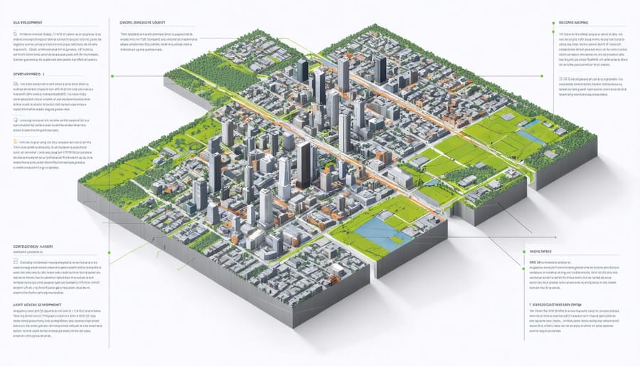
The emergence of digital twin technology represents a significant leap forward in urban modeling capabilities. These virtual replications of cities incorporate IoT sensor data, creating dynamic models that reflect real-time urban conditions. Planners can simulate various scenarios, from traffic flow modifications to climate change impacts, before implementing changes in the physical environment.
3D visualization tools have become increasingly sophisticated, offering photorealistic renderings and immersive experiences. These tools allow stakeholders to understand proposed developments from multiple perspectives, improving communication and decision-making processes. Advanced rendering capabilities now include shadow studies, view corridor analysis, and wind pattern simulations, essential for evaluating environmental impact.
Cloud-based GIS solutions have democratized access to powerful spatial analysis tools, enabling collaborative planning across different departments and stakeholders. These platforms support real-time updates and version control, ensuring all parties work with the most current data and models.
The integration of artificial intelligence with GIS has introduced predictive modeling capabilities, helping planners anticipate future urban growth patterns and infrastructure needs. Machine learning algorithms can analyze historical spatial data to identify trends and suggest optimal development strategies, making urban planning more proactive and efficient.
Public Engagement Platforms
Digital platforms have revolutionized public participation in urban planning, transforming traditional community engagement methods into dynamic, interactive experiences. These technologies enable planners to reach broader audiences and collect more meaningful feedback through various digital channels.
Geographic Information Systems (GIS)-based participation platforms allow citizens to interact with proposed development plans through intuitive map interfaces. Users can drop pins, draw areas of concern, and provide location-specific feedback that planners can analyze quantitatively. Notable examples include Urban Interactive Studio and Commonplace, which have achieved participation rates up to five times higher than traditional consultation methods.
Mobile applications dedicated to urban planning feedback have become increasingly sophisticated, incorporating augmented reality features that enable residents to visualize proposed changes in real-time. Citizens can view 3D renderings of planned developments through their smartphone cameras, offering a tangible understanding of how projects will impact their neighborhoods.
Social media integration has proven particularly effective, with platforms like Facebook and Twitter serving as valuable channels for gathering public opinion and disseminating planning information. Analytics tools built into these platforms provide planners with demographic insights and engagement metrics, helping to ensure representative community participation.
Virtual town halls and online forums have gained prominence, especially following the global shift toward digital communication. These platforms facilitate real-time discussions between planners and community members, complete with polling features, breakout rooms, and document sharing capabilities. Success stories include Boston’s “Beta Blocks” initiative, which achieved a 300% increase in community engagement through its digital platform.
Digital engagement tools also address accessibility concerns by offering multilingual support and compatibility with screen readers, ensuring inclusive participation across diverse community segments.

Implementation Case Studies
Several groundbreaking implementations of technology in urban planning demonstrate the transformative potential of digital solutions in modern city development. Singapore’s Smart Nation initiative stands as a premier example, utilizing a comprehensive network of sensors and IoT devices to monitor everything from traffic patterns to energy consumption. The city-state’s Virtual Singapore platform, a dynamic 3D city model, enables planners to simulate and analyze various urban scenarios before implementation, resulting in a 30% reduction in planning-related costs.
Barcelona’s successful implementation of smart city technologies offers another compelling case study. The city’s Superblocks program, supported by advanced traffic modeling software and real-time data analytics, has reduced vehicle traffic by 40% in pilot areas while increasing pedestrian space by 25%. This initiative aligns with broader urban resilience strategies and has become a model for sustainable urban transformation.
In Copenhagen, the integration of digital twin technology has revolutionized infrastructure management. The city’s comprehensive 3D model incorporates real-time data from over 20,000 IoT sensors, enabling precise monitoring of flooding risks, air quality, and traffic flow. This system has helped reduce emergency response times by 20% and improved resource allocation efficiency by 35%.
The Boston Smart Utilities Program presents an innovative approach to infrastructure planning. Using predictive analytics and machine learning algorithms, the city has optimized utility maintenance schedules and reduced operational costs by 25%. The program’s success lies in its ability to integrate multiple data streams from various urban systems, creating a cohesive planning framework that anticipates and addresses infrastructure needs before they become critical.
Portland’s Climate Action Plan exemplifies the effective use of GIS technology and environmental modeling software. The city’s planners utilize advanced spatial analysis tools to identify heat islands, optimize green space distribution, and plan climate-resilient infrastructure. This data-driven approach has contributed to a 15% reduction in urban heat island effects and improved stormwater management efficiency by 40%.
These case studies demonstrate that successful technology integration in urban planning requires not only sophisticated tools but also careful consideration of local context and stakeholder needs. The measurable improvements in efficiency, sustainability, and quality of life underscore the value of investing in smart city technologies.
The integration of technology in urban planning has fundamentally transformed how we design, develop, and manage our cities. As demonstrated throughout this analysis, digital tools like BIM, AI, and IoT sensors have become instrumental in creating more efficient, sustainable, and livable urban environments. The evidence from successful implementations worldwide shows that these technologies not only streamline planning processes but also enable data-driven decision-making that benefits both city administrators and residents.
Looking ahead, the future of urban planning technology appears increasingly promising. We can expect to see greater integration of quantum computing and advanced AI systems, enabling more sophisticated predictive modeling and real-time urban management solutions. The continued evolution of digital twin technology will likely facilitate even more precise urban simulations, while emerging blockchain applications may revolutionize land management and property development processes.
However, success in this technological transformation requires careful consideration of infrastructure requirements, data privacy concerns, and the need for skilled professionals. As cities continue to grow and face new challenges, the strategic implementation of these technologies, combined with human expertise, will be crucial in creating resilient, smart cities that serve their communities effectively.